Parramatta Road Stories AIR Lyndal Irons

Do you have a story to share?  Local Notes invite you to share your stories with current Artist in Resident, Journalist and Photographer Lyndal Irons

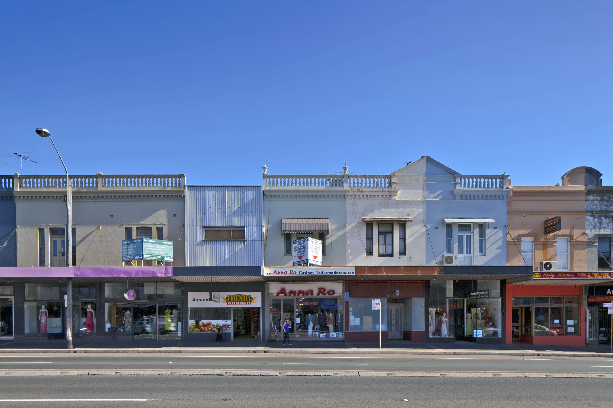
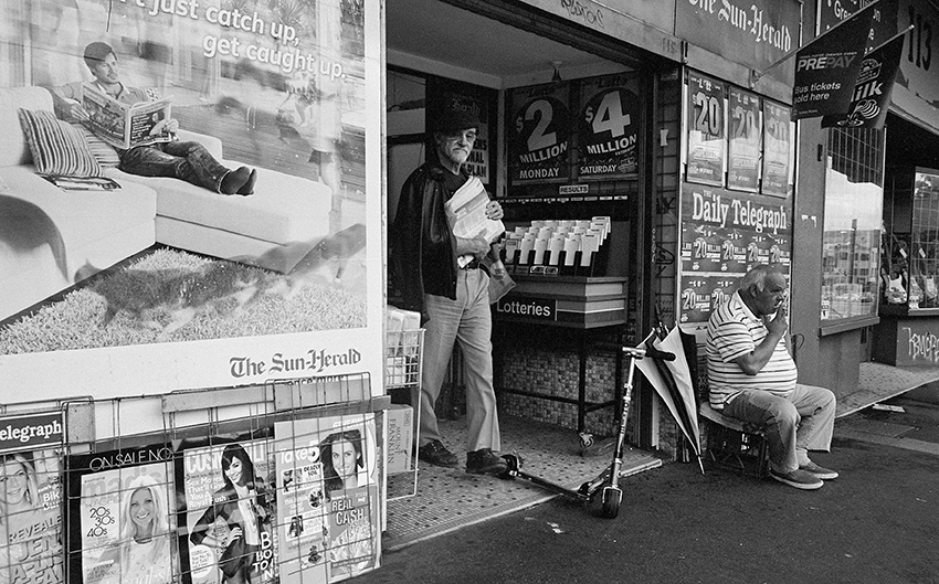
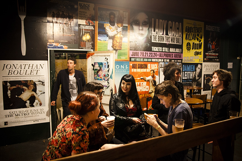
Frequently branded one of Australia’s worst roads, Parramatta Road was also Australia’s first inter-settlement pathway between two colonies. Once populated by Indigenous tribes and bushrangers, I aim to restore a sense of journey to a road better known for daily transit. Part documentary photography and part road trip, my series preserves today’s road for future reference and encourages a deepened experience of the everyday.

75_Lyndal-Irons_wedding-packages (14)

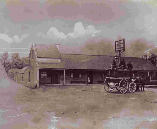
c. Lesly Irons “wedding-package”

Lyndal-Irons_Annandale Hotel_135a_20120713-IMG_0472 (1)

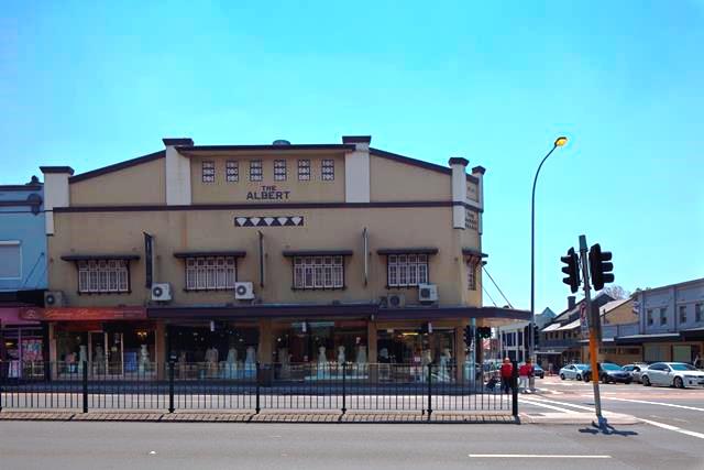
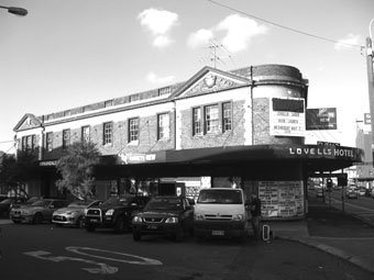
c. Lyndal-Irons_Annandale Hotel

During my AIR with Leichhardt Council, I’m looking for leads and stories from local residents, businesses and pedestrians on Parramatta Road. I’m interested in absolutely everything: residential life, business, your experiences on Parramatta Road. I’m also open to suggestions about what you would like documented, requests and nominations for people and businesses you think deserve recording, parts you value, parts that interest you, aspects you love or hate. I photograph and also interview people and places to tell the story of road through its people and communities.

As part of the Parramatta Road Goes Pop, Lyndal Irons will be inviting people to tell her their tales of “Parra Road.” Lyndal will be located at 121 Parramatta Road for the month of September. Contact her via her email address to make an appointment info@lyndalirons.com.au She would love to hear from you.

Email: info@lyndalirons.com.au.

Please feel free to add comments and anecdotal stories on the blog in the comments field.

Parramatta Heritage Street Project – What are your thought’s of Parramatta Road?

In light of the WestConnex proposal the changing face and use of Parramatta Road could change dramatically. Here at Leichhardt Council we have undertaken the task of photographing the Leichhardt Local Government Area side of Parramatta Road form Hawthorne Canal to Mallett Street Camperdown.

Photograph by Emilio Cresciani

Photograph by Emilio Cresciani – Parramatta Heritage Streetscape Project.

Parramatta Road has had a long and rich History as one of Sydney’s main artillery connecting the city to Parramatta, originally Sections of the current Parramatta Road were an Aboriginal walking track for the Dharug nation which resided in the area.

Parramatta Road was one pf the earliest colonial transport Routes in Australia. It linked the two original European settlements at Sydney Cove and Parramatta.

The Parramatta Road corridor also has a rich and diverse urban heritage host to iconic buildings with a rich history such as The Bald Faced Stag, Sydney’s oldest Pub opening in 1830 on the corner of Parramatta Road and Balmain Road.  It holds the record of having held a continuous license perhaps longer than any hotel in the Commonwealth.  Other Iconic Buildings include the Albert Palais, The Empire Hotel, The Annandale Hotel

Bald Faced Stag.

Bald Faced Stag C.1830 originally Colonial late Victorian Italianate. It has changed architecturally style four times. Now a two story brick structure with ornamented Parapet in the Inter War Free classical style.

The Albert Palais – The Grand Ballroom

Photograph by Emilio Cresciani

103 Parramatta Road The Empire Hotel

Nowadays The Empire Hotel is stop on QC Mark Tadeschi Eugeni Falleni walking tours.

Along the Parramatta corridor there are approximately 146 items on the State Heritage Register and 3747 statutory listed items on local environmental plans ore regional environmental plans.


ananndale-hotelsmall

Annandale Hotel 17 Parramatta Rd, Annandale NSW 2038

Parramatta Road Heritage Streetscape by Emilio Cresciani

In response to the large scale proposed changes to Parramatta Road under the WestConnex Project, the Leichhardt Council Heritage Advisory Committee have facilitated a Local History grant to create a photographic panorama and heritage streetscape of Parramatta Road which documents all the buildings on the Leichhardt Local Government Area side of Parramatta Road – from Hawthorne Canal to Booth Street – approximately three kilometres long.

This project contributes to a cannon of famous documentations of streetscapes, a valuable record for now and the future.

Parramamtta Road Street Project3 from Localnotes on Vimeo.

(right click to turn off quick start)

Parramatta Road has been a major artery linking the two settlements in Parramatta and Sydney from early colonial times. Progressive improvements to the size and type of road reflect changing technology and urban use.

Governor Macquarie called tenders for the repair of the track in 1815 and widened it to ten metres. The Sydney Municipal Council set about widening the major routes into the city with the Sydney end of Parramatta Road widened and improved in 1910-1911.

The 20th Century also saw the advent of motorised traffic on the road, and in the 1920s the surface of the road was sealed and trams were removed from the road.

Today, over three million commuters use Parramatta Road each year.

The street is characterised by high street shops in buildings dating from the nineteenth and early twentieth centuries. The streetscape is rich with Victorian, Edwardian / Federation, Art Deco and 20th Century architectural styles. Today it is known as a strip for wedding dress shops, pubs, camera stores, 1960-70s milk bars.

Emilio Cresciani’s photo essay preserves a unique moment in the history of this major artery and contributes to the social history and photographic archive of Sydney. It continues the legacy of documentation of key times and periods in Sydney’s growth and the global practice of street documentation.